
Official Washington
Local lore has it that no building in Washington, D.C., can be higher than the US Capitol (or is it the Washington Monument?), but the real reason behind the federal Height of Buildings Act (1910) was the reach of fire-fighting equipment at the time the legislation was enacted. Under the Act, the maximum height of buildings in the city is limited to the width of the street plus twenty feet. The long-range effect of this law is that the city has a decidedly horizontal skyline. That in turn means that the two tallest federal structures, the aforementioned Capitol and the Monument, can be seen from many locations around the city, even from miles away.
I had been working at Georgetown University, commuting into the city from suburban Maryland, for eight years before I realized that the people who live and work in Washington have a completely different visual experience of these and the Capital City's many other historic buildings and memorials than do the tourists and other visitors. Postcard images of the these structures isolate them from their surroundings, but those who live here regularly see them surrounded by traffic, poking up above roof lines, and seen at the far end of long avenues. It reminded me of Hokusai's
Thirty-six Views of Mount Fuji,
and in 2000 I began photographing these familiar strucrtures in that unfamiliar manner. In the process I revisited over the years some of the same views as the city has changed.


Washington is laid out in a grid that is divided into quadrants: NW, NE, SW, SE. The US Capitol is the central point in that grid. This distant view of the Capitol dome, seen faintly at the notch in the tree line, was taken from the north, at the point where Rhode Island Ave crosses over North Capitol St. Little has visibly changed since this photo was taken in 2014.


To those who live here, the Washington Momument is simply "the Monument." It, too, can be seen from many points throughout the city, in this case from the Rhode Island Metro Station overlooking the Brentwood Post Office in NE Washington. In the enlarged image on the right you can see an approaching Red Line Metro train just below the Monument, coming up a long grade as it approaches the station. 2001


Here are four more views of the Monument: (1) Looking West from the North end of the old Douglass bridge in 2000. (2) The Monument can be seen on the horizon at the far left in this view taken from across the Anacostia River on a cold morning in November of that same year. (3) As seen from the Tidal Basin, 2002. (4) From the waterfront along Maine Ave SW, 2011.


I started photographing "official" Washington at the South end of the East/West dividing line, where South Capitol St crossed the Anacostia River over the old Frederick Douglass Bridge. I took these views from that bridge in 2000. They show what a visitor to Our Nation's Capital would have first seen when driving into the city from that direction 25 years ago. The
Capitol dome rises in the far distance, just as it did in the view from the North, but in this case, the area between the dome and the viewer is filled with old warehouses and gritty light industrial operations, including a concrete supplier whose facilities sat right on the riverfront. The second photo shows the historic Navy Yard waterfront on the Anacostia River, adjacent to the area in the first photo.

A few years can make a huge difference. In this 2009 photo taken from aproximately the same location, the Capitol dome can barely be seen in the distance, just to the right of center, squeezed in between the new Nationals baseball stadium and other new buildings. This image covers the same area of the waterfront as the two previous photos: the brick building built out over the water can be seen in both the old and new views. In the intervening years most of the area's old construction has been replaced with new apartment buildings, hotels, and retail spaces, but as you can see, the concrete company's operations are still standing on prime property, right on the waterfront, next to the new stadium.

Now jump another 15 years to 2024. This view was taken from the new Douglass bridge, as close to the same spot over the river as I could get. Still more new apartment buildings have been built on the land formerly occupied by the concrete company. These new buildings now block not only the view of the Capitol dome, but that of the Washington Nationals stadium itself. Large hotels and apartment buildings have also been build north of the stadium, between N and I ("Eye") Streets SE. Now you can't see the Capitol until you swing around a large traffic circle near the stadium (off to the left, just out of this picture) and turn up South Capitol St. The dome then rises up straight ahead of you.

Here is a notable example of the development north of the stadium. This “before" view was taken in 2011 at the intersection of South Capitol St. and I St. SE., including the entrance to the Southeast / Southwest Freeway (I-695, which turns into southbound I-395). As you can see, a McDonald's claims this prime location just a few blocks from the Capitol.

Here is the "after" picture of that same intersection today. The empty lot that I stood in to take the earlier pamorama is now the site of a self-described "luxury" apartment building, located behind me and to my right as I took this photo. Similarly, the McDonald's has been replaced by the apartment complex seen here on the right. The entrance to the Interstate remains unchanged. 2024

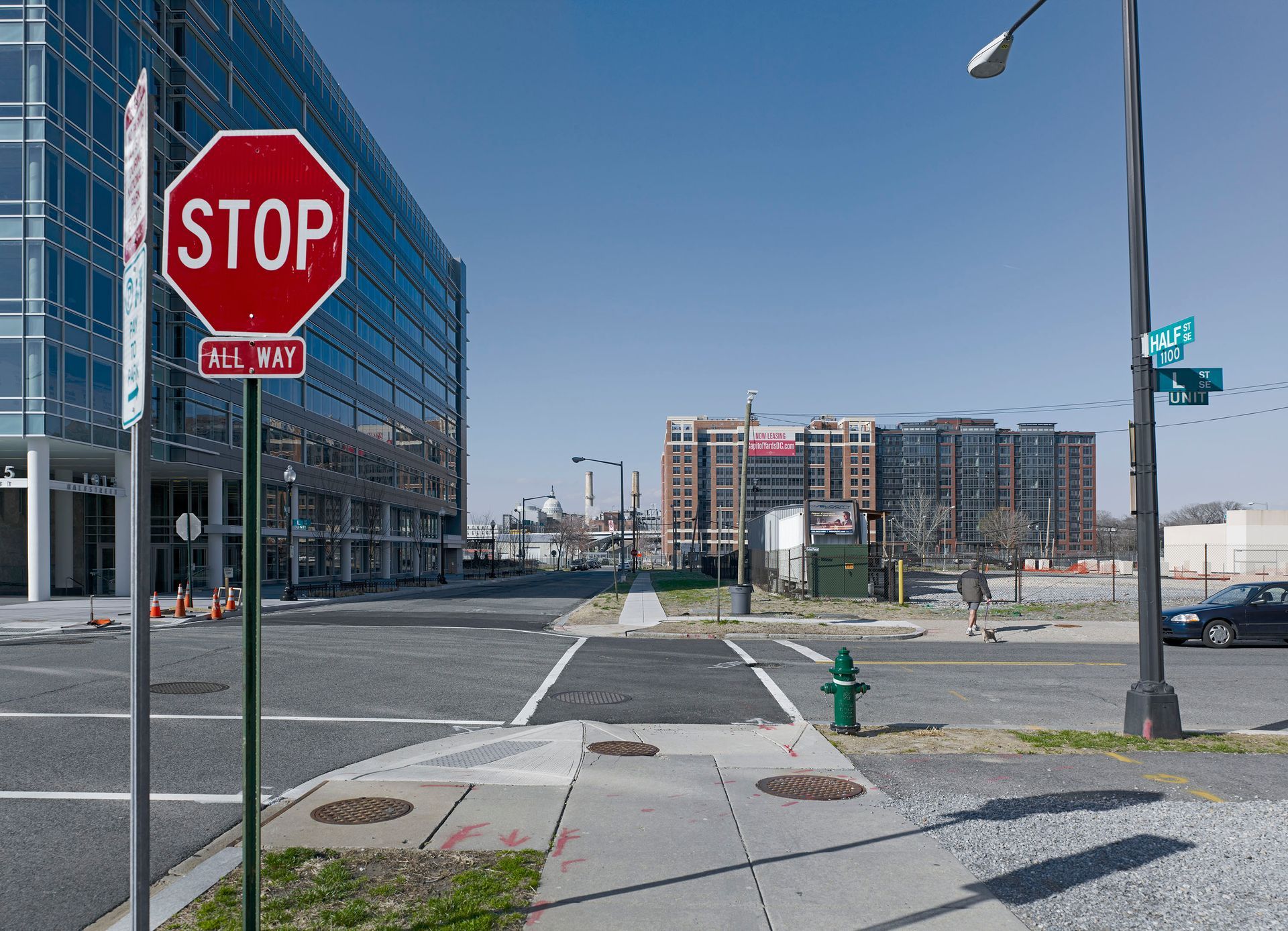

These three photos provide striking evidence of the changes in this area over the past 25 years. All were all shot at the intersection of L and Half Streets SE. The first image was shot in 2002. If you click on it you can see the Capitol dome rising above a long row of warehouses. This area was filled with similar utilitarian structures, relics of its history as part of a working waterfront.
In the second photo, from 2011, the warehouses to the left have been replaced with a sleek office building with a glass curtain wall exterior. The red and blue-painted brick buildings on the right have been removed, providing a clear view of a new high-rise brick-clad apartment building. You can still see the Capitol dome, but it appears to huddle between the two new buildings and behind the Capitol Power Plant.
The third image was shot in March 2026. The Capitol dome is no longer visible and once the trees are in full leaf, even the Power Plant's chimneys will be out of sight. The far apartment tower visible in the second photo is now hidden by many more like it: new apartment buildings now completely cover this area.
In the intervening years, my equipment and technique have evolved along with all the new construction. The first photo was shot on film with the workhorse Calumet 4x5 that I have had since the early 1970s. The second photo was shot with a Phase One digital back mounted on an Arca Swiss 6x9. The third was shot with a Leica M11-P.
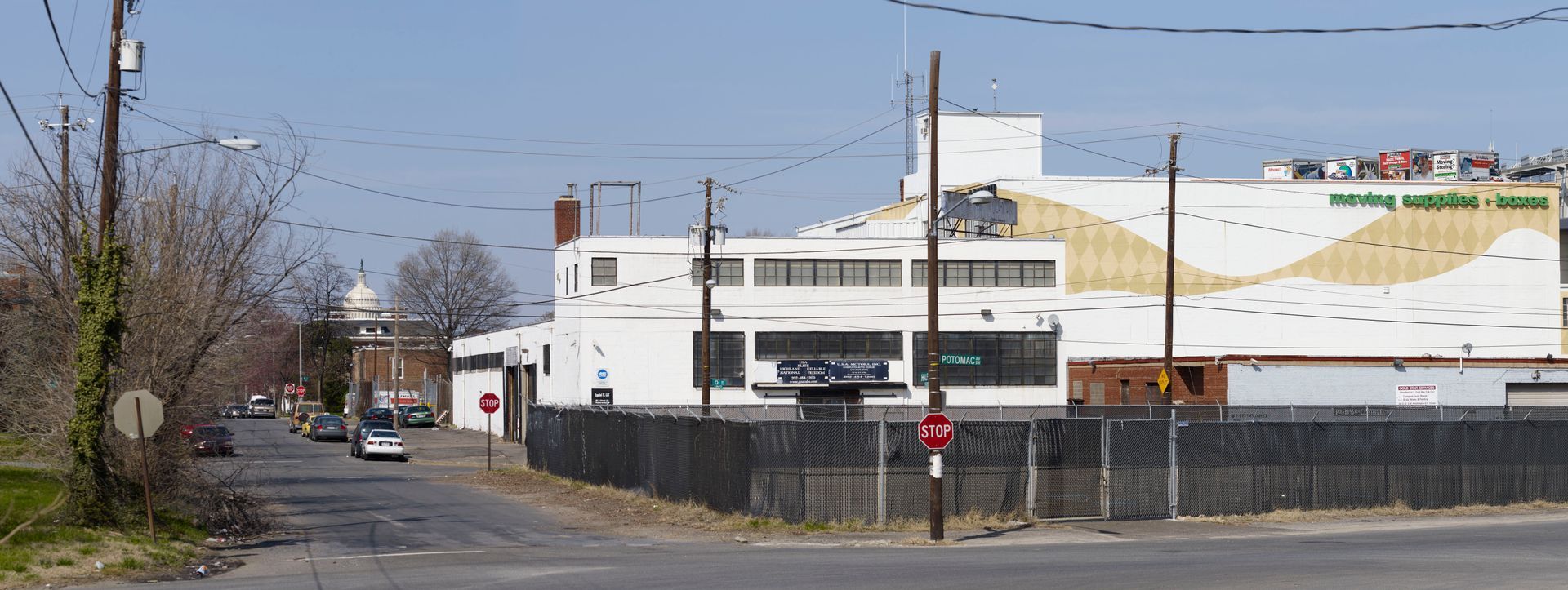
The Capitol dome seen from Potomac Ave and Half St. SW, on the West side of South Capitol St. 2011

The Lincoln Memorial has a low profile and can best be seen head-on, standing at the far end of the Reflecting Pool. From the surrounding streets,
it can almost seem to be hidden. This view of the Monument's South side is from the intersection of 23rd St SW and Independence Ave. 2021

The John Ericsson Memorial stands at the same intersection as the previous photo, where 23rd St SW, Independence Ave, and Ohio Drive all meet. Ericsson, a Swedish engineer, developed the first iron-clad warships, and is particularly recognized for having designed the USS Monitor, the ship that was key to Union naval supremency during the Civil War. Ericsson also invented the screw propeller to drive such ships. The memorial was designed by James Earle Fraser and was dedicated in 1926 by President Calvin Coolidge. In a nod to the naval connection, I took the four photos from each of the four main compass points.

Continuing on Independence Ave, you curve around the Lincoln Memorial to its Northwest corner, where the street turns into Rock Creek and Potomac Parkway NW. Once again, the Monument seems to be hiding behind the trees and shrubbery. 2021


The Jefferson Memorial sits at a prominent place on the Tidal Basin, but it too has a low profile and can be seen only if you are nearby, and even then, often all you can see is a glimpse of its dome. Here are three views from the surrounding roadways. The first two photos are from 2002; the third is from 2011.


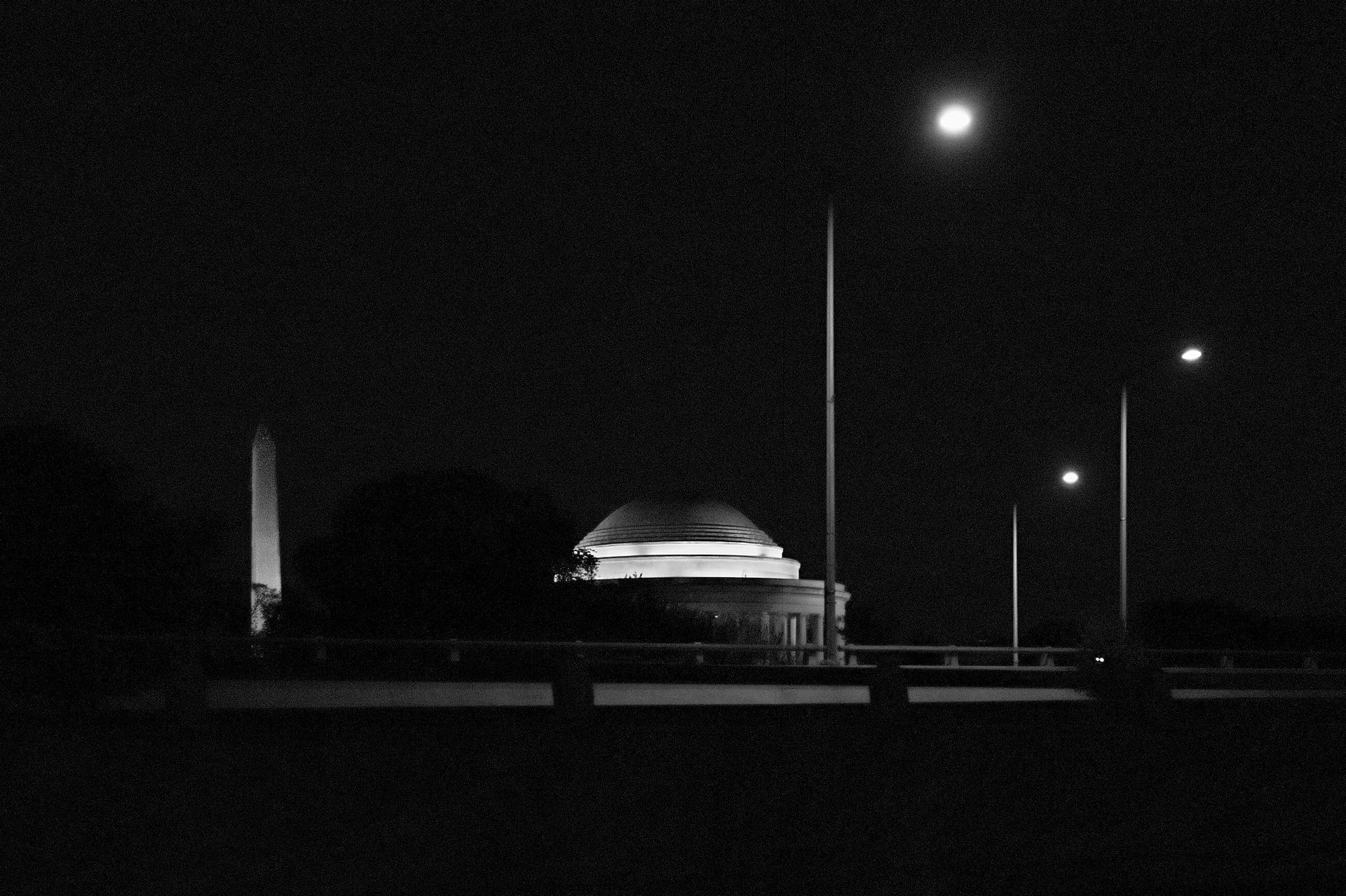
Three more views of the Jefferson Memorial: from Ohio Drive SW in winter, 2011; at night, 2016; and seen with the Monument at night, 2016.
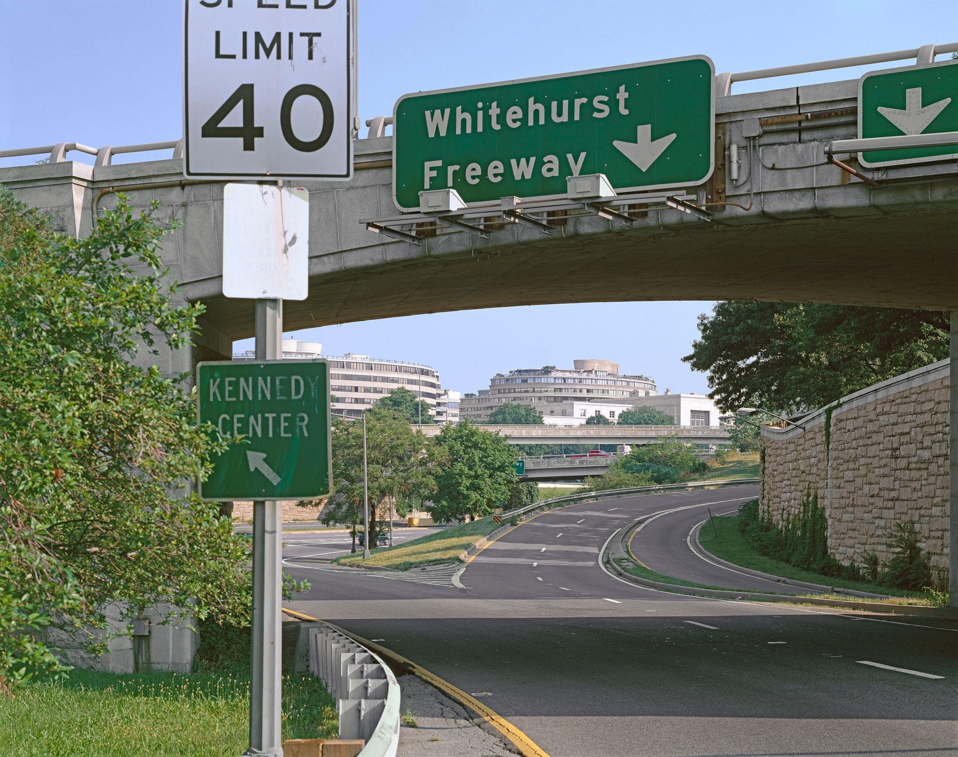
Not far from the Lincoln Memorial, and adjacent to the Kennedy Center, is the Watergate complex: five buildings, including the two curved buildings seen beyond this overpass, that incorporate coop apartments, a luxury hotel, and offices. While the building is not owned or operated by the federal government, the Watergate became inextricably linked to Washington’s political history for its connection to the scandal that led to resignation of President Richard Nixon. 2000
Other views from the National Mall

The Capitol dome from the National Mall, with glimpses of the West and East buildings of the Natiional Gallery of Art to the left. 2019

Entrance from the National Mall to the East building, National Gallery of Art. I. M. Pei, 1978. 2019

Entrance from the National Mall to the West building, National Gallery of Art.
John Russell Pope, 1941. 2019

The FDR Memorial. 2012

"Why should I be standing in line, just waiting for bread?"
FDR Memorial. 2012
This line is from the song "Brother, Can You Spare a Dime?," composed
by Jay Gorney with lyrics by "Yip" Harburg. The song swept the nation
when it was recorded by Bing Crosby and others in 1932, during the depths
of the Great Depression.

The Great Depression was followed by the Second World War . . .
The WWII Memorial, with the Monument behind it. 2004

. . . which was followed by the Korean War . . .
The Korean War Memorial in winter. 2002

The Korean War Memorial at dusk. 2016

. . . which was followed by the Vietnam War. 2021
The Vietnam Veterans Memorial, a nearly 500-foot-long gash of black granite sunk into the earth, incised with the names of more than 58,000 members of the U.S. armed services who died or remain missing as the result of their service in Vietnam or Southeast Asia.

The Vietnam Veterans Memorial, Memorial Day. 2002