
Hyattsville: Jefferson to Hamilton St
The 5300 block of Baltimore Ave/US 1 has undergone the most dramatic change of any area that I've photographed in this project. My first photos were taken in November 2005 of these three buildings in the center of that block:

Click on the thumbnails below for enlarged images:


Enlarged you will be able to read the signage for the six tenants: a storefront ministry with associated bookstore in the first building, two diners in the second, and a mattress shop and Hispanic food market in the third. You can also see the modest Art Deco details, especially in the second and third buildings: each has a sunrise pediment and faux grooved columns with pyramidal capstones. These details are characteristic for the build dates I found in real estate records: 1932 for the second and third buildings, and 1939 for the first.
From that same period, here are two night shots of the bookstore and the Bed-To-Go shop; click on them:


By 2013-14 the storefronts have changed:

2014 2013
In the second building, the first of the two diners seems to still be in business: the formerly pink facade has been repainted pale green and a prominent, bright blue awning has been added. The second diner, which was formerly painted off-white, is now golden yellow, but the gutted sign above the doorway and the for-lease poster in the window are sure signs that it is no longer serving customers. And it is hard to believe that the
Bed-To-Go is still a going concern as three of its four windows frame the same objects as they did eight years before. To the left of the door, what looks like a small mattresses sample and a fallen sign lie in front of a curtain that hasn't been moved; to the right, the same mattress as before leans against the window. The only change in the display is a different sign shouting MATTRESS SALE. In the fourth building, the former Hispanic market is now vacant, its painted dual-language signage scraped off the plate glass windows.
Click the thumbnails for details:


By 2018 all the buildings have been vacated and are slated for demolition:

Two local interior designers spearheaded an effort, supported by the developers, to have artists decorate the soon-to-be-demolished buildings to brighted the neighborhood and discourage graffiti and more egregious forms of vandalism. Their effort was part of an informal national movement under the hashtag #fighttheblight.
Two of the images in this panorama are shots of the South walls of the buildings whose East-facing facades are shown to their right. The last building to the right, a white, multi-door garage, was formerly yet another auto service center that did not catch my eye when I shot the earlier versions of this panorama.
Click below for enlargements:


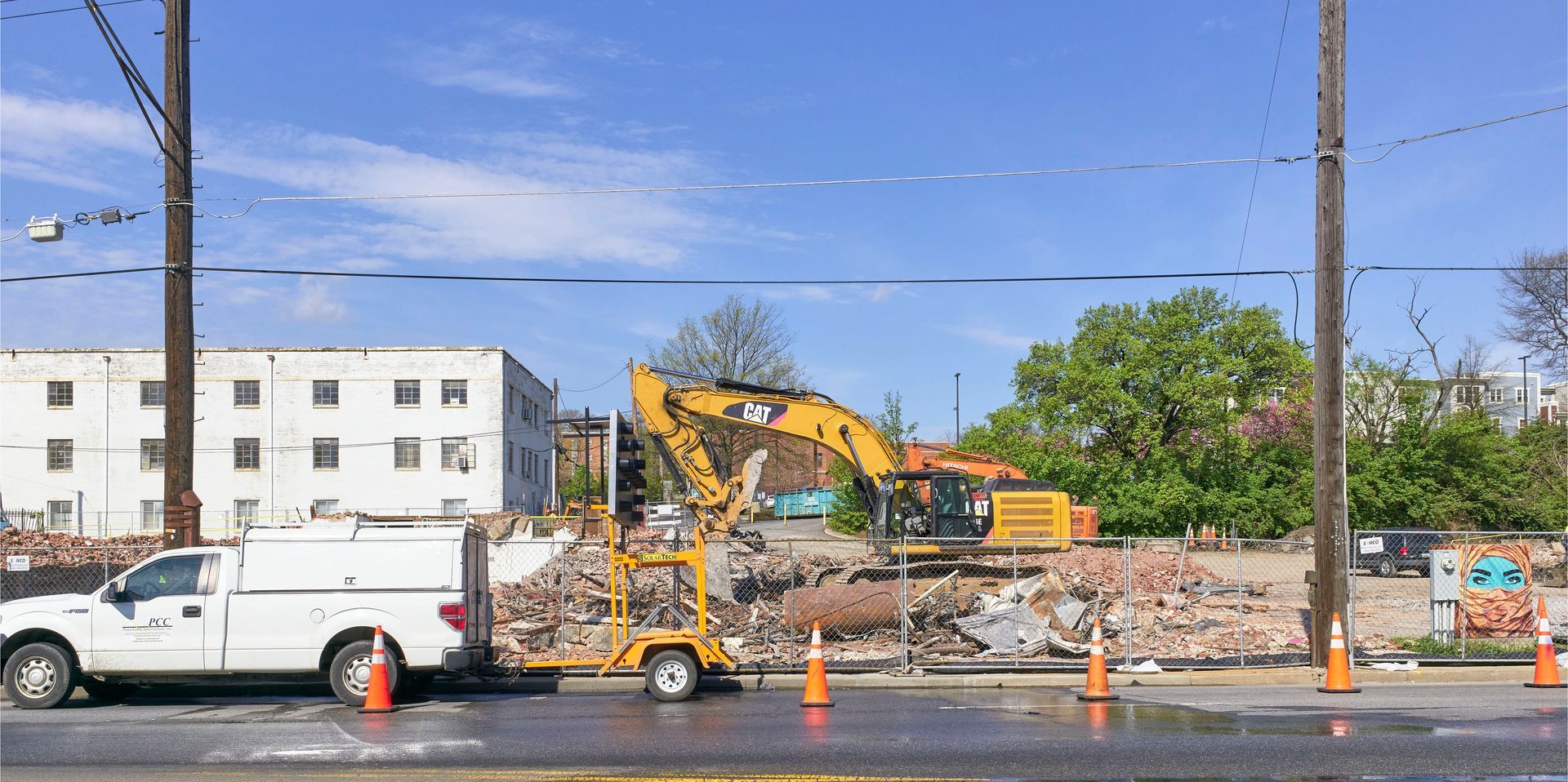
Four years later, in 2022, everything but the fortress-like church on the far left has been demolished and the remains, mostly piles of brick, are being hauled away. The church on the far right will remain.

Click for enlarged views:


Finally, as seen in 2026. The entire block, except for the stone chuch on the right, has been replaced with apartment housing and space for ground-floor retail businesses:

Click for enlarged views:


If you look closely at the second frame of the 2026 panorama, you will see that I am standing at a crosswalk where, according to the signage on the traffic signal, Hamilton St meets Baltimore Ave/US 1. Hamilton actually crosses the busier road with a dogleg turn, after which it continues West, but to the East, it is a one-block long dead end.
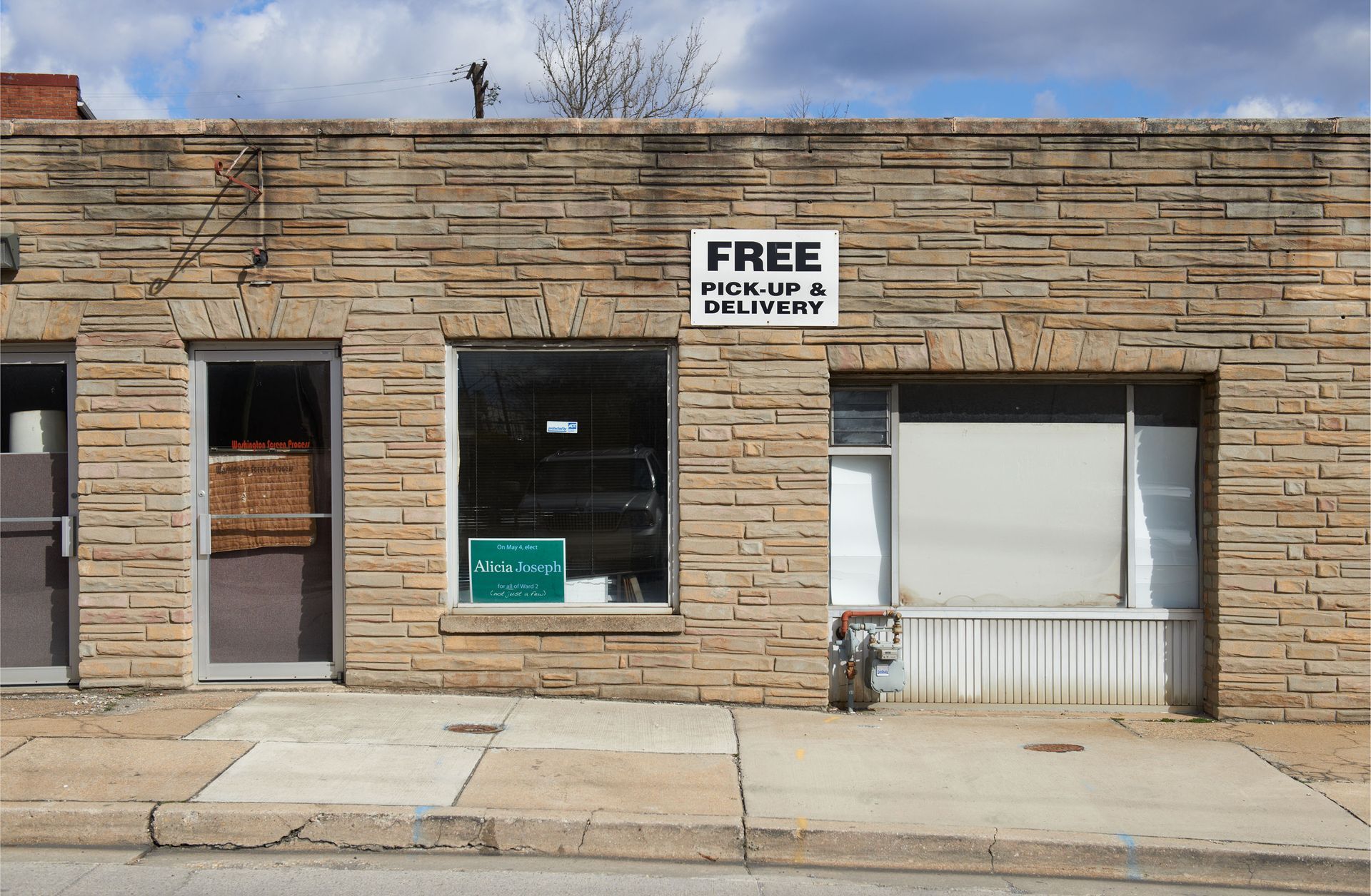
For years that one block looked pretty much like this:

Click for an enlarged view:


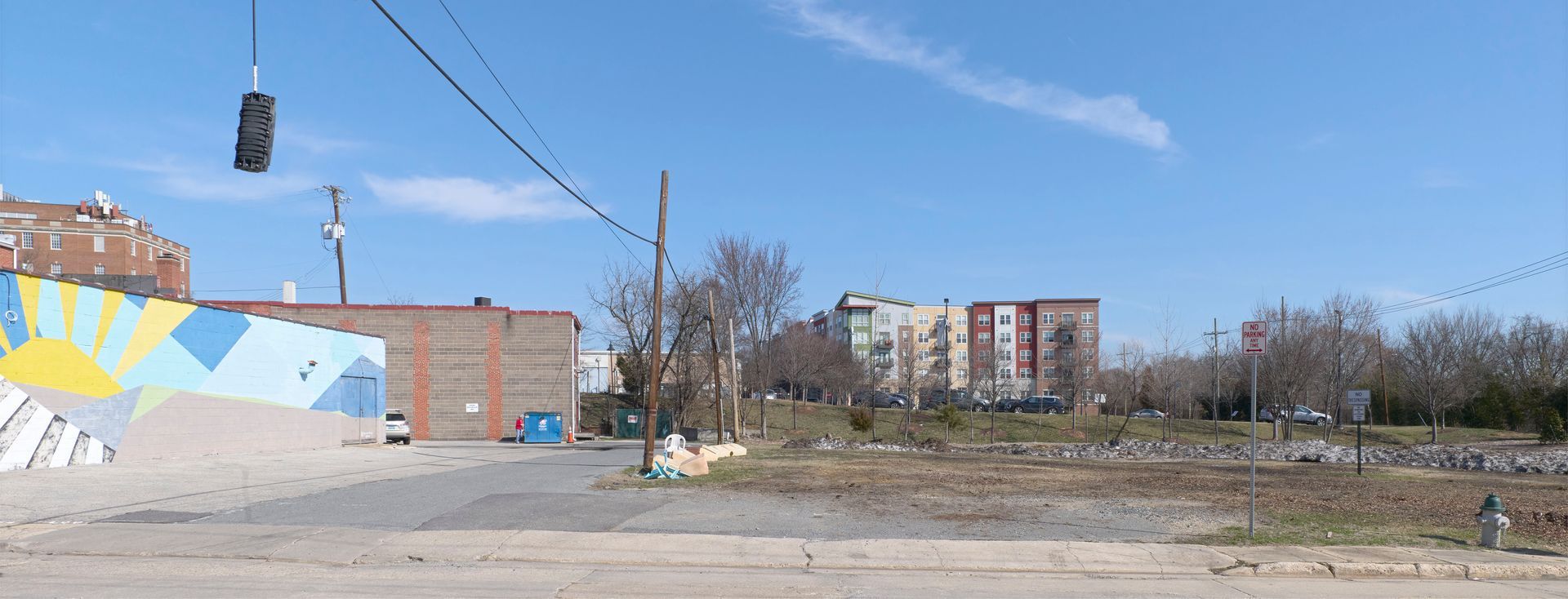
Now some change is evident:

Click for enlarged view:


Since the signage in the windows of the remaining building is all so small, click below for even bigger enlargements:


XXXXXXXXXXXXX


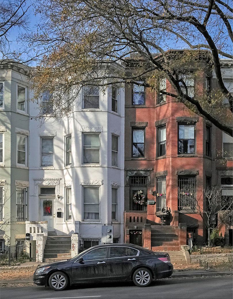


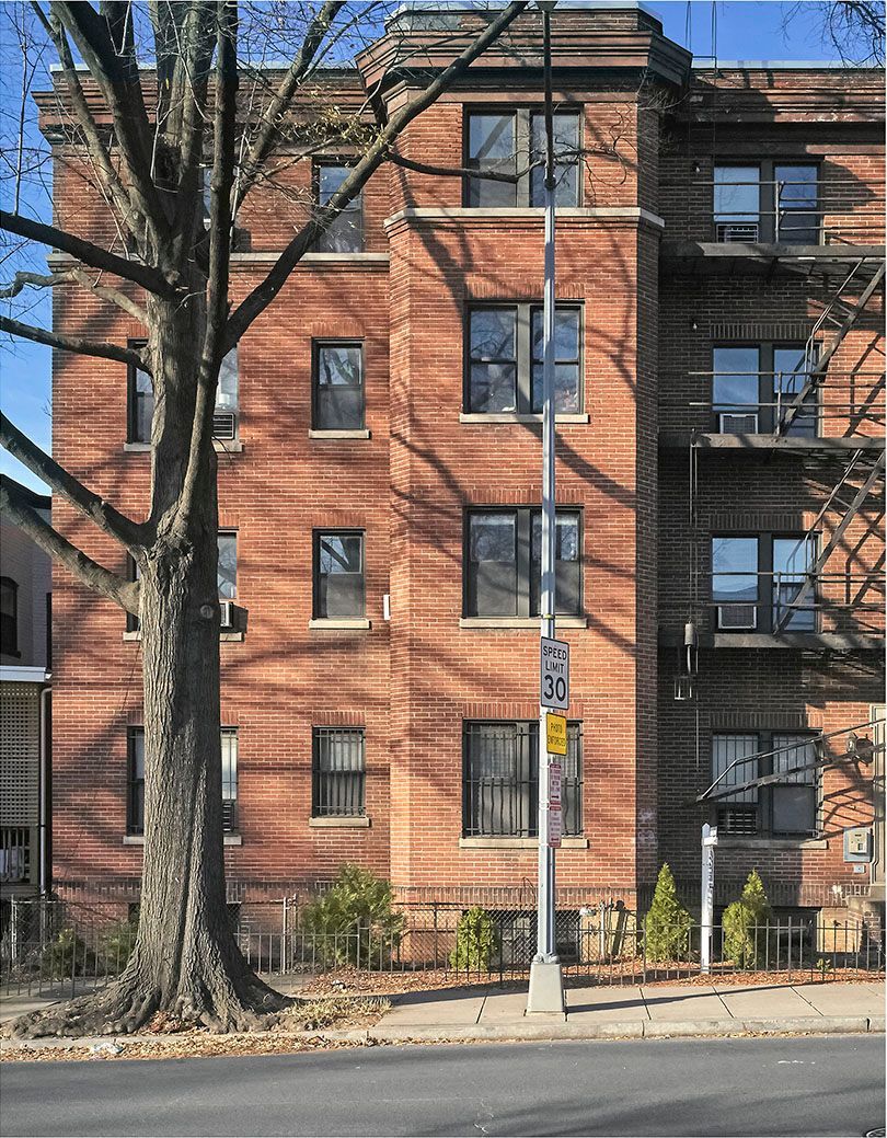

In the mid-1890's, Washington's street grid was extended beyond the borders defined by Pierre L'Enfant's original plan. Boundary Street, about three blocks to the left of this image, was renamed Florida Av and the newly absorbed land was platted for development. Harry Wardman, an English immigrant who had worked his way up in the construction trades to become a builder himself, worked with architect Nicholas Grimm to fill this part of town with brick row houses, both small "two-flat" units and larger (and more profitable) buildings, like these, all of which were built with the distinctive facade seen here: a projecting multi-story window bay, often topped with a conical or polygonal roof. And sometimes with additional flourishes, like the Moorish archways surrounding some of these front doors, or on the other side of the street, ornate carvings in limestone trim. These whimsical designs still unify the neighborhoods in this part of town more than a century later. (Historical information from “Housing Washington,” ed. Richard Longstreth, 2010.)
A technical note: When I started this project more than 25 years ago I first shot 4x5 chromes, then used an early digital back mounted on a Hasselblad. To make panoramic street views, I had to walk down the street, shooting multiple images head-on, then piece them together with the seams showing. That is how the 2006 Lustine photo, with the white spacing between the images, was made. Since then I have acquired a higher resolution digital back which I mount on either a 6x6 or 4x5 technical camera. Coupled with with a selection of wide-angle view camera lenses, I am now able to shoot grids of up to 12 or more digital images that I can then merge seamlessly. The 2011 Lustine image is a simple example of that technique, merging three exposures.